Monday, September 30, 2013

Fire Management in the Bitterroot National Forest


A blog by Kelsey McMullen and Katie Kinney

The 2013-2014 Wilderness and Civilization class went to the Bitterroot National Forest with our Forest Ecology professor, Andrew Larson. There, we collected data on one hectare of forested land that has had strict fire suppression since 1908. In the study, there are 9 plots in 3 different national forests. We recorded data for the Bitterroot 4 plot, or B4, in Canyon Creek, Bitterroot National Forest. The experiment, Age-Class Structure of Old Growth Ponderosa Pine/Douglas-Fir Stands and Its Relationship to Fire History, was conducted in 1993 by Stephen Arno, Joe H. Scott, and Michael G. Hartwell. The purpose of this study was to research the effects of fires and fire suppression on Old Growth Ponderosa Pine (Pinus ponderosa) stands. In this study, the focus in particular was the age-class structure of the stands. The plot is approximately 100-m square, or one hectare. This plot was last measured in 1993.

Fire suppression, instituted by the Forest Service in the early 1900’s after the catastrophic 1910 fires, had a long term effect on the growth of forests. Bitterroot 4, a plot that historically burned every 13 years, has not experienced a fire since 1908. The result of this fire suppression has caused significant growth in the understory that otherwise would not be present with frequent fire. As mentioned in Andrew Larson’s lecture, without a natural, regular fire regime in an old growth Ponderosa Pine forest, the study plot would be a low severity fire regime, that being a plot with old growth Ponderosa Pine and little understory growth, minimal variation in species differentiation, and higher limb placement on the trees to protect from the trees from the height of the fire. We saw firsthand that other species we able to thrive without the process of regular fires. There was a notable increase in other tree species growth compared to forests without fire suppression as studied in our Forest Ecology class. This includes growth of more fire intolerant and shade tolerant species, such as Douglas-Fir (Pseudotsuga menziesii) and Grand Fir (Abies grandis), as well as Lodgepole Pine (Pinus contorta) and Subalpine Fir (Abies lasiocarpa). Understory shrubs were present in high densities as well, including Kinnikinnick (Arctostaphylos uva-ursi), Thimbleberry (Rubus parviflorus), Snowberry (Symphoricarpos), and Huckleberry (Vaccinuim).  There were also large amounts of coarse woody debris (CWD) as a result of infrequent fires to remove the dead trees and logs. The result of the understory growth and CWD is competition for nutrients, water, sunlight, and space, as well as a higher risk for a high intensity and severity fire to strike the area.

The study produced both a graph with the location of each tree within the hectare and a chart of the data. The chart displayed the tree species, tag number, diameter breast height, age (by core sample), and notable conditions of tree (dead, alive, beetle kill). Using both the data on the chart and the graph for reference, we were able to easily identify and locate each tree. For quick reference on the chart, there was an abbreviation for each tree species using the genus and species of each tree. For example, Ponderosa Pine was POPI, Douglas Fir: PSME, the Grand Fir: ABGR, and lastly, Lodgepole Pine: PICO.

We used a special loggers measuring tape which has centimeters multiplied by 3.14, or pi, to measure the diameter of each tree. We divided our group into 4 smaller groups and combed the site to record each tagged tree. We did encounter challenges such as fallen tagged trees, which required rolling logs over and some tags were completely consumed by the tree which we could find on the graph but not on the ground.

After we collected the data, Andrew Larson demonstrated how to collect core samples from a tree using his increment borer. He explained that sampling a tree does not affect the health of a tree because the sample is too small to do any serious damage.

While monitoring in B4, we also found signs of wildlife. We saw many piles of bear scat, most likely black bear, as well as the remains of a snowshoe hare, flickers, and hornets (which had a special liking for Myles). One of the Ponderosa trees that we monitored had bear scratches about breast height, and looked like they continued all 
the way up the tree. We predict that when the tree was younger, a bear came along and climbed high onto its branches, and the claw scars were still visible. The hornets and flickers both made homes in the dead snags around the site.


As a group, we learned about data collection and forest monitoring. This field trip was applicable to what we had covered in our lectures and readings. Not only was it fun to collect data on a 20-year-old study plot, but changed the way we look at a forest.

A trip in the Anaconda-Pintler Wilderness

A blog by Sarah Capdeville


This weekend’s trip brought us to the Anaconda-Pintler Wilderness, an area of around 160,000 acres west of Anaconda, Montana. We came in through Fishtrap Creek on the southeast side of the wilderness and completed a near-loop for a three-day, two-night backpacking trip.

The focus of the trip was wilderness character monitoring; the Wilderness and Civ group would be completing monitoring on the final stretch of trail in the wilderness. This monitoring included using a GPS unit to mark data points that reflected noise (such as airplanes flying overhead), weeds, stream erosion, trail signs, and campsites. By comparing previous years’ data with the data we collected, wilderness managers can document use over time and produce concrete figures for the character of the wilderness.

We also had some fantastic experiences in the unique landscape of the AP. We camped in a beautiful subalpine larch forest where an icy cold stream wove through mossy clearings and over jagged rocks. The larch population is in fact the most southeastern population in Montana, and this time of year the trees were just turning a fantastic pale yellow. Winter had beaten us to the higher elevation; small clumps of snow rested in logs and in rock crevices. Thick whitebark pine also populated the area, looking surprisingly healthy despite the depressing evidence of their decline due to climate change.

On the second day, we split up and explored above the tree line, scrambling up the red talus slopes first to the Lost Lakes and then to East and/or West Goat Peaks, leaning against the biting autumn wind pushing over the ridge-top. West Goat Peak, standing at 10,793 ft, is the tallest in the Anaconda-Pintler Wilderness, but wasn’t to difficult of a climb. It gave us spectacular views of the surrounding wilderness and Western Montana, including the Bitterroots and other ranges.

Another part of our wilderness character monitoring included wildlife, especially the iconic pika. Its characteristic “meeep!” calls sounded down from the rocky slopes, and on our last morning we spent some time sitting at the base of the talus slopes watching for the scurrying brown shapes. Pikas are adapted to cold, high-altitude habitats where they have access to both concealing rocks and forage. In order to survive the winter, pikas stockpile “hay-piles,” or mounds of forbs and grasses they forage below. The pika, like the whitebark pine, is greatly threatened by climate change. It can’t tolerate temperatures above 80 degrees F, and with temperatures rising, the pika has nowhere to go. We saw and heard a fair number of pikas, and thoroughly enjoyed watching them pose on rocks and call sharply into the clear air.

The trip showed us some beautiful country as well as making us aware of wilderness character. We took more notice of airplanes flying overhead and the impact of campsites. There is so much to take in when you’re in a wilderness area, especially when it comes to the character of the place. With quantitative data collecting, we were able to pinpoint aspects of wilderness that affected our overall experience, and that of future users. Still, the drone of a plane couldn’t damper our spirits too long with the squeak of a pika echoing on the talus slope above.

Characterizing Wilderness!!


A blog post by Danny Savage

Located in southwestern Montana, the Anaconda-Pintler Wilderness is stunning.  Designated in 1964, the Anaconda-Pintler was one of the first areas to be deemed wilderness.  It now has a total of 158, 615 acres.  Elevations range from 5,100 ft. to the 10,793 ft. West Goat Peak.  In the lower elevations, one can find sagebrush and willow flats before rising to forests of fir, pine, and spruce as well as aspen, sub-alpine larch, and whitebark pine.
            The Wilderness Act of 1964 defines wilderness as “...untrammeled by man, where man himself is a visitor who does not remain.  (It is) Federal land retaining its primeval character and influence, without permanent improvements and human habitation…’wilderness areas’…shall be administered…so as to provide for protection of these areas (and)…the preservation of their wilderness character…” The Wilderness Act goes on to state “…each agency administering any…wilderness shall be responsible for preserving the character of wilderness.”  However, the Act does not give guidelines for preserving wilderness character.  If we read the characteristics of wilderness as described by the Act, we can get a sense of what we can do to preserve wilderness character.  The characteristics of wilderness, as defined by the Act, are untrammeled, undeveloped, natural, and opportunities for solitude or primitive and unconfined recreation. 
            Founded in 1975, the Wilderness Institute’s mission is to further understanding of wilderness and its stewardship through education, research, and service.  The Wilderness and Civilization Program is part of the educational component.  Another thing that the Wilderness Institute does is wilderness character monitoring.  This past summer, they monitored the Anaconda-Pintler, hiking 208 trail miles and recording 147 weed patches (8 species), 120 hikers, 76 recreation sites, and 47 pikas.  Field measures are just one aspect of wilderness character monitoring, which helps inform proposed actions and impacts.  There was one section of trail remaining for the Wilderness Institute to monitor in the Anaconda-Pintler so the Wilderness and Civilization students traveled to help finish the job. 
            On Friday, September 20, we separated into two groups.  One group hiked straight to our campsite while the other group monitored along the trail.  Using a GPS and a pen and paper, we recorded such things as noxious weeds, signs, trail quality, wildlife evidence, and sounds outside of the wilderness such as airplanes.  The hike, about 5 miles or less, had some steep ascents.  I was particularly impressed by the grassy, wet meadows that we encountered at fairly high altitudes during the hike.  When we arrived at the campsite below East Goat Peak, it was nearly dark.  The site itself was gorgeous with a nice stream and a stunning cluster of old trees. 
            On the following morning, we hiked up to East and West Goat Peaks.  The hike was incredible with turquoise alpine lakes, a little snow on rocks, and two summits that provided panoramic views of the mountains and lakes around us.  It was very cold up there.  I am glad I was prepared with enough layers.  I felt so alive and free!
            On the following morning, we searched for pikas at the foot of the rocky hills leading up East Goat.  We saw at least four of the cute, furry, little creatures.  After, we hiked out of the wilderness.  This time, I was with the group who hiked straight to our destination while the other group monitored.  Along the trail, we saw a lot of evidence of wildlife, including moose and bear tracks and scat as well as a bear’s skull and bones.  Even though it was short, this field trip was awesome and was what I needed to clear my mind from the worries that come with civilization.


Friday, September 20, 2013

Sustainable Transportation Field Trip


Blog post by Nate Conners and Ben Williamson

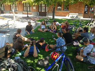
The first Wilderness and Civilization trip of the 2013-2014 school year involved a day of biking with Bob Giordano.  Bob is the founder of MIST, Missoula Institute for Sustainable Transportation, as well as the owner of Free Cycles, a grass roots community bike shop.  The Wilderness and Civ class was fortunate enough to be able to see Missoula through the eyes of a very involved community member, and a leader in the sustainable transportation field.  Bob explained many ideas and concepts from ways to regulate car traffic, to ideas that would promote bike and foot travel, as well as alternative materials and surfaces that would be better for the environment.  Bob has a vision to shift our city landscape from a rigid, mundane, and unnatural design to a more natural and organic scheme.  In a sense, Bob wants to incorporate the naturalness of the wilderness into urban design.  He sees a need to blend wilderness and civilization to promote human connection and unity. It was truly a pleasure to be able to spend so much personal time with someone who is such a local visionary.
One of the first topics we discussed was the implementation and use of traffic circles and round-abouts in the Missoula area.  These would be an alternative to stop lights and stop signs, and are generally considered safer and more efficient, but also save on electricity and some city planning.  One such example is the round-about on Higgins and Beckwith, near the University of Montana campus.  This has been an extremely successful use of a round-about and has had a great impact on the local area.  Prior to the implementation of the Higgins and Beckwith round-about there were about three accidents and one fatality a year.  These were associated with the traffic light that used to occupy the intersection.  Since the round about was installed in the Fall of 2009 there have been no fatalities or collisions at the intersection.   Round-abouts are also noted for their ability to force cars to drive more slowly in the surrounding neighborhoods, and the communities reaction to this particular round-about has been very positive.  Bob believes in a traffic system that flows naturally, yielding and shifting, similar to the fluidity of a river.  The current stoplight system, in which drivers are continuously stopping and speeding encourages irrationality and ensuing “road rage”.
Another topic that was discussed was ways to make Missoula more bike friendly.  There are several types of bike lanes including buffered (bike lane separated from the street by parked cars), cycle track (a bike lane that is essentially on the sidewalk, but is separated from pedestrians) and conventional bike lanes that are right next to the car traffic on the street.  Bob talked to us about how a city can use these bike lanes to make transportation safer for both bikers and cars.  In a city like Missoula, in which biking is often a primary means of transportation for many students and workers, it is important to have a safe system in which both bikers and drivers show respect for each other.
Bob also discussed several projects that the city of Missoula is undertaking.  One of which involves the construction of a second round-about on Toole Ave.  There is also a push to turn 5th and 6th St into more accessible and safer commuter routes.  Bob is also advocating for the construction of plazas and piazzas around downtown Missoula, similar to the squares and courts that dominate many of Europe’s cities.  He believes that a city must have meeting places for its citizens.  One of my favorite quotes of Bob’s was, “There is no democracy if there is no conversation and connection.”  He thinks that a city with meeting places devoid of cars fosters relationships amongst people.  It could push people out of their everyday bubble and allow people to interact spontaneously with each other.
On one of our stops during the bike rides we stopped at a new park being constructed off the bike path near Osprey stadium.  Near the parking lot, a bike rack section was being built.  The surface that the bikes will sit upon is not concrete or asphalt, rather it is a psyllium based material that is as strong as asphalt, but is a much healthier and environmental friendly material.  Pysllium can be used a binding agent along with crushed granite to form a permeable pavement.  This surface is a healthy and renewable surface, without the toxic and oily runoff that occurs on asphalt tops.  Bob believes that this material is a viable option that should be implemented on many of the pathways and sidewalks around Missoula.
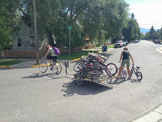
Finally, the Wilderness and Civ class had a chance to see Free Cycles and help set up for the Festival of Cycles event held at McCormick Park on Saturday September 14th.  Part of the event entailed giving away over 50 children’s bicycles to the Missoula community.  Along with giving the bikes away, Bob will teach the family how to maintain the bike.  A bike is only good for as long as it is in good condition.  Bob is passionate in teaching people how to do upkeep on the bikes they own.  Many kids in the Missoula community will benefit from Bob’s passion for alternative transportation.
All in all, it was great day filled with intellectual discussion, good ideas and lots of biking and sun.  A great way to start off the 2013-2014 field trip schedule.